Menu
Drone survey infrastructure
DRONE SURVEY & MAPPING

Aerial
infrastructure
intelligence.

Advanced UAV mapping systems for infrastructure corridors, terrain analysis, industrial planning, orthomosaic generation, and construction intelligence workflows.

UAV CAPABILITIES
Orthomosaic Mapping
Terrain Analysis
Corridor Intelligence
Progress Monitoring
Drone infrastructure survey
Infrastructure corridor
FLIGHT ANALYTICS
AERIAL INTELLIGENCE

High-speed mapping
from above terrain.

SATMOS drone survey systems enable rapid aerial data acquisition, orthomosaic generation, topographic intelligence, and infrastructure-scale mapping workflows for complex operational environments.

RTK
Precision Positioning
4K
High Resolution Mapping
UAV CAPABILITIES

Drone intelligence
for terrain-scale
infrastructure.

Advanced UAV systems for aerial surveying, corridor mapping, industrial monitoring, and real-time infrastructure intelligence workflows.

Drone surveying and infrastructure intelligence
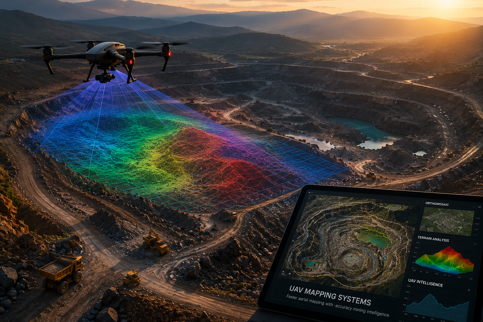
UAV Infrastructure Systems

Survey intelligence
across complex terrain.

Advanced aerial surveying systems designed for infrastructure corridors, industrial zones, terrain analysis, and large-scale geospatial operations.

01

Orthomosaic
Mapping

Precision stitched aerial imagery for infrastructure visualization, planning, and terrain analysis workflows.

02

Terrain
Intelligence

Elevation systems, contour generation, and spatial terrain interpretation for infrastructure-scale environments.

03

Progress
Monitoring

Real-time aerial visibility for industrial construction, infrastructure execution, and operational monitoring systems.

EXECUTION WORKFLOW

From flight planning
to aerial intelligence.

01

Flight Planning

Mission planning optimized for terrain, corridor geometry, and infrastructure scale.

02

UAV Capture

High-resolution aerial acquisition using RTK-enabled drone systems.

03

Data Processing

Orthomosaic generation, terrain modelling, and aerial data refinement.

04

Final Deliverables

GIS-ready outputs, terrain intelligence, and infrastructure documentation.