Menu
Mining drone survey operations
MINING GEOSPATIAL INTELLIGENCE

High-Precision
Drone Survey
Solutions for Mines.

Advanced drone mapping, DGPS/RTK survey, stockpile analysis, terrain modeling, and geospatial intelligence for modern mining operations, excavation planning, and infrastructure development.

RTK Accuracy Centimeter-Level Precision
Large Area Coverage Rapid UAV Mapping
Mining Intelligence Terrain & Volume Analytics
OPERATIONAL ADVANTAGES

Faster

Survey execution across complex mining terrain.

Safer

Reduced manual exposure in hazardous zones.

Smarter

Actionable geospatial data for mine planning.

CORE MINING CAPABILITIES

Advanced geospatial
workflows for modern
mining operations.

Drone Mapping

Rapid aerial surveys, orthomosaic generation, and high-resolution terrain intelligence.

DGPS / RTK Survey

Centimeter-level positioning for mining layouts, boundaries, and control points.

Stockpile Analysis

Accurate volumetric calculations for excavation monitoring and material estimation.

3D Terrain Models

Detailed contour mapping, elevation analysis, and digital terrain visualization.

Mine Progress Monitoring

Track excavation activity, expansion progress, and operational developments.

GIS Intelligence

Geospatial datasets, layered mapping systems, and mining analytics workflows.

COMPREHENSIVE MINING SURVEY SOLUTIONS

Integrated survey,
mapping & terrain
intelligence systems.

Mining survey and drone operations
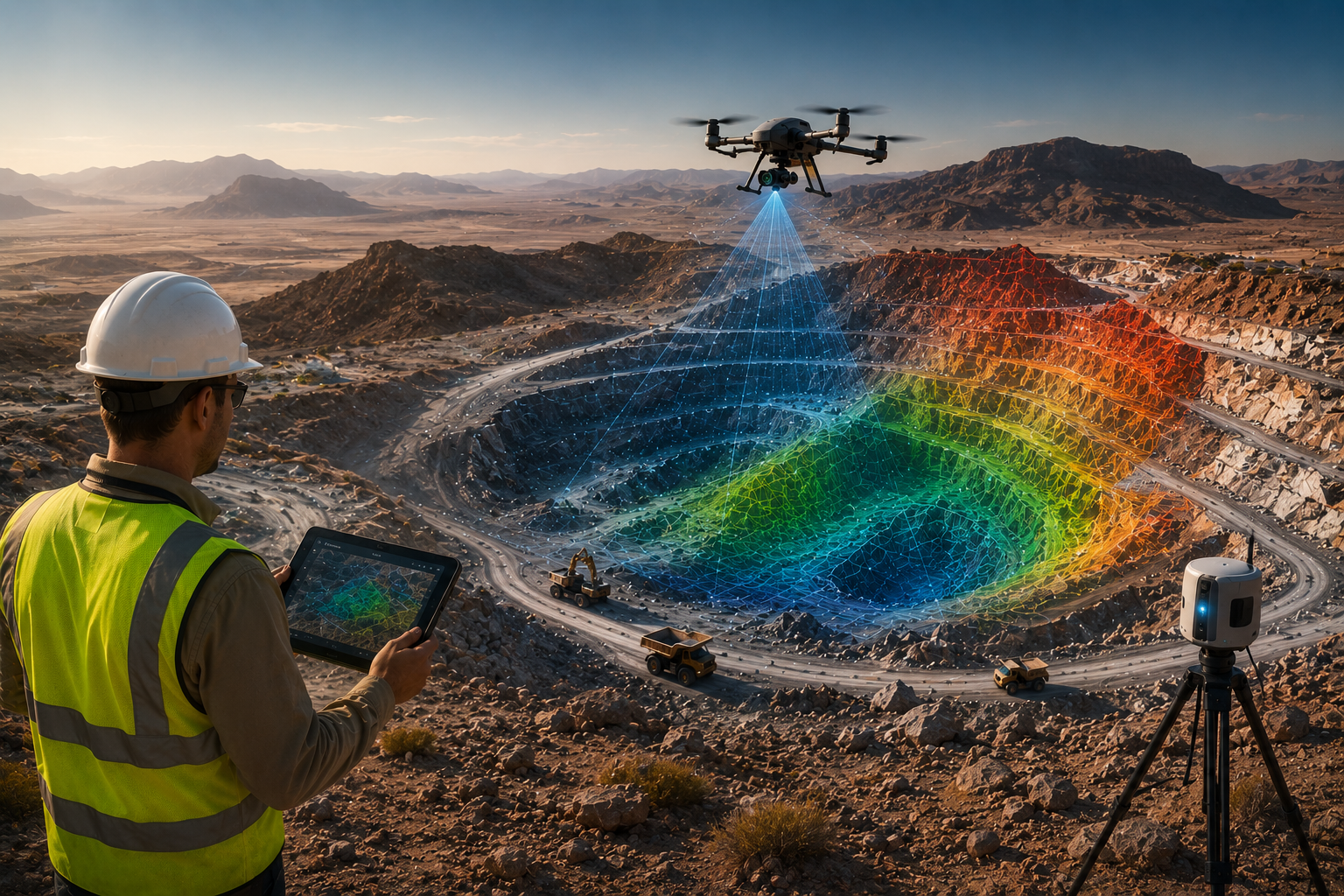
UAV SURVEY • DGPS • GIS • TERRAIN ANALYSIS

Precision geospatial systems for modern mining operations.

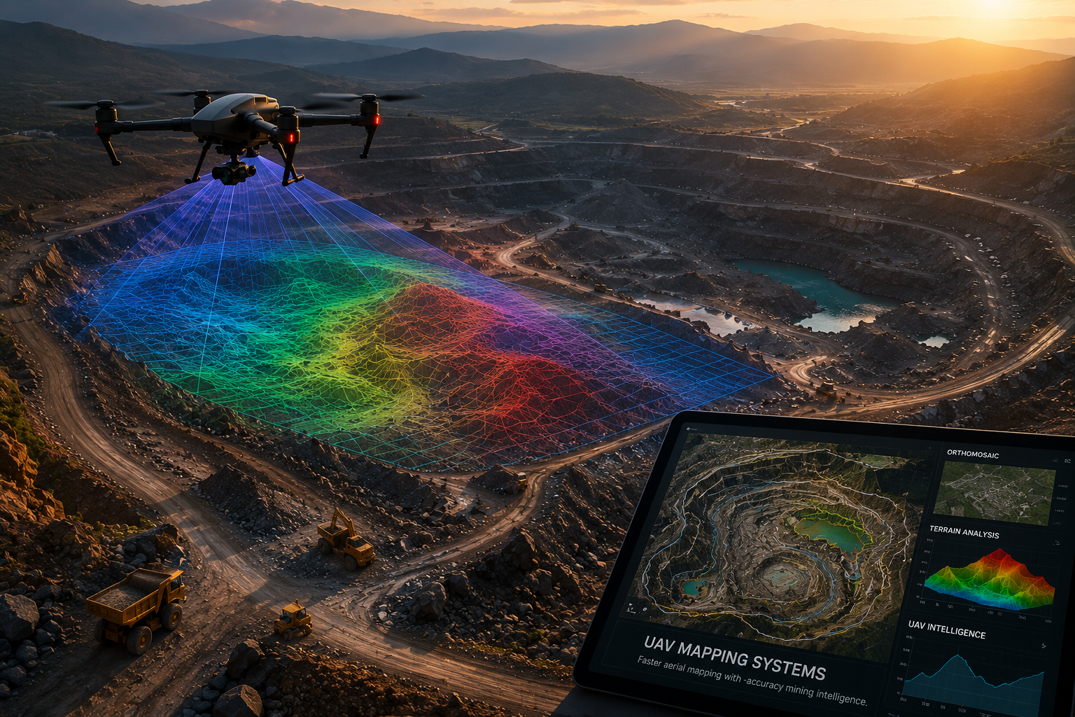
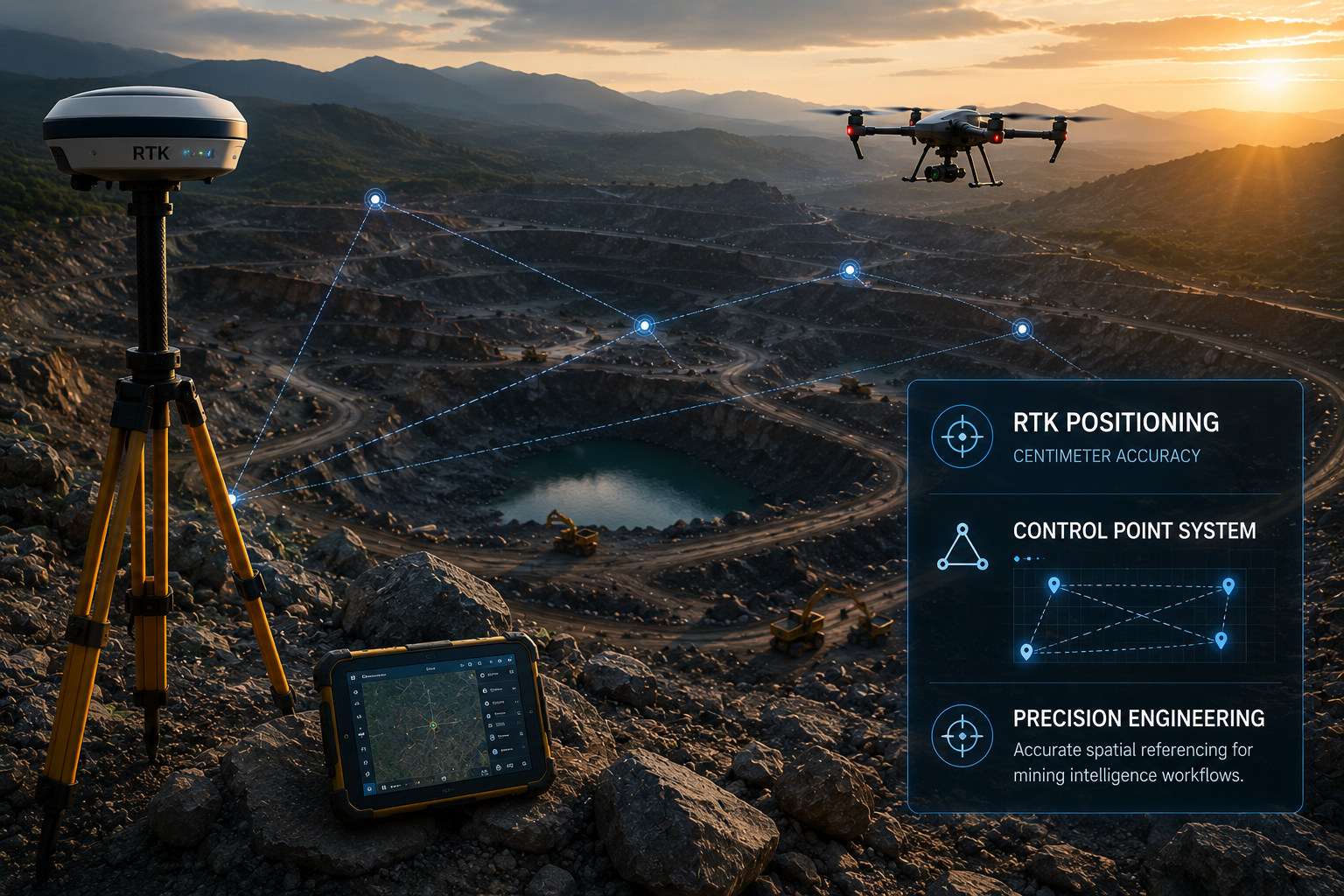
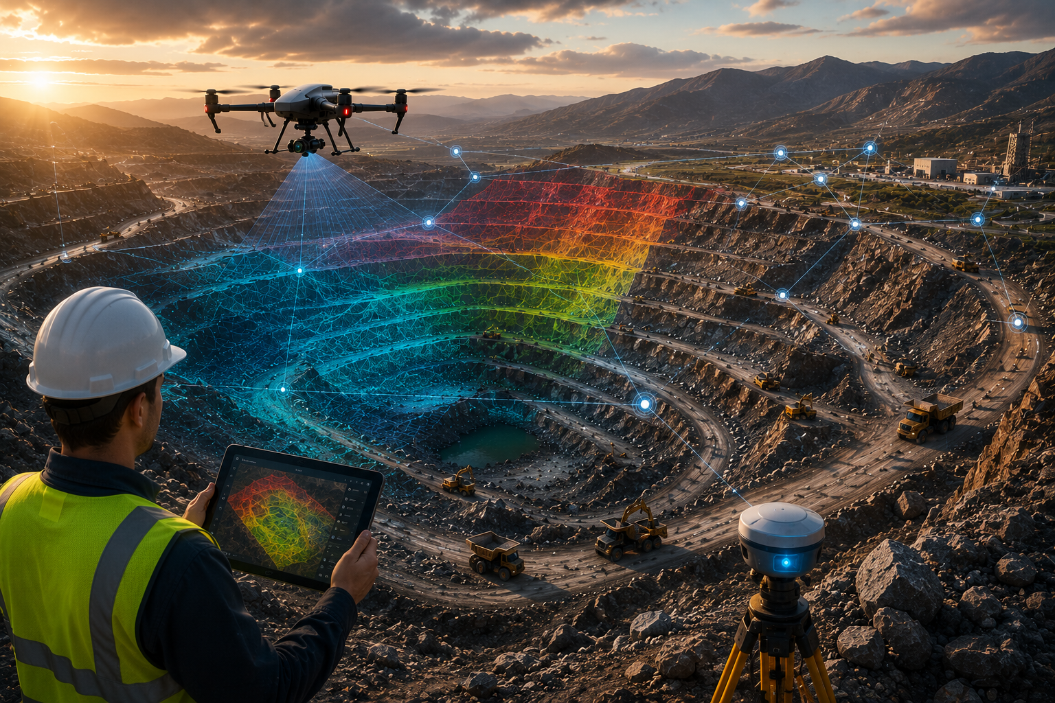
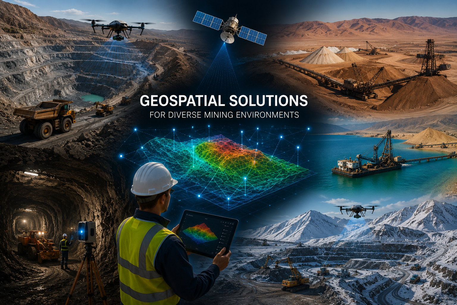
SATMOS delivers integrated drone survey, DGPS/RTK positioning, stockpile analysis, contour mapping, terrain modeling, and geospatial intelligence workflows for mining infrastructure, excavation planning, operational monitoring, and resource management.

MINE PLANNING & ANALYSIS

Smarter terrain intelligence for excavation and planning.

High-resolution aerial mapping and terrain analysis support haul road alignment, slope assessment, cut-fill calculations, and excavation strategy planning.

Mining operations and terrain intelligence
OPERATIONAL MONITORING

Faster site visibility and mining progress tracking.

Monitor excavation activity, stockpile movement, site expansion, and operational changes using repeat drone surveys and geo-referenced mining datasets.

DRONE-BASED MINE MAPPING & ANALYSIS

High-resolution aerial
intelligence for large-scale
mining environments.

Drone mapping and mining terrain analysis
ORTHOMOSAIC
TERRAIN ANALYSIS
UAV INTELLIGENCE
UAV MAPPING SYSTEMS

Faster aerial mapping with high-accuracy mining intelligence.

01

Rapid Large-Area Coverage

Drone survey workflows enable fast mapping of extensive mining zones, excavation areas, haul roads, and operational terrain with minimal downtime.

02

Safer Survey Operations

Reduce manual exposure in hazardous excavation zones, unstable terrain, and active mining environments through UAV-based data acquisition.

03

Actionable Mining Intelligence

Generate orthomosaic imagery, elevation models, terrain analytics, and geospatial datasets for operational planning and infrastructure development.

DGPS & RTK PRECISION SURVEY SERVICES

Centimeter-level
positioning for
mining accuracy.

SATMOS delivers high-precision DGPS and RTK survey workflows for mine boundaries, excavation planning, control point establishment, terrain referencing, and geospatial data validation across complex mining environments.

Control Point Establishment

Accurate geo-referenced control systems for mining layouts, planning, and infrastructure alignment.

RTK Accuracy Workflows

Real-time positioning systems supporting highly accurate mining survey and terrain analysis operations.

Geo-Referenced Mine Data

Reliable spatial datasets integrated with UAV mapping, GIS systems, and engineering deliverables.

DGPS RTK survey operations
RTK POSITIONING
CENTIMETER ACCURACY
CONTROL POINT SYSTEM
PRECISION ENGINEERING

Accurate spatial referencing for mining intelligence workflows.

STOCKPILE VOLUME & EARTHWORK CALCULATION

Accurate volume analytics
for smarter mining
operations.

Mining stockpile analysis and earthwork calculation
VOLUME ANALYSIS
EARTHWORK DATA
3D STOCKPILE MODELS
OPERATIONAL ANALYTICS

Precision material estimation and excavation monitoring workflows.

01

Stockpile Volume Calculation

Generate accurate volumetric measurements for coal, aggregates, minerals, and excavation material using drone-generated terrain datasets.

02

Cut & Fill Analysis

Analyze earthwork movement, excavation progress, and terrain modification with highly detailed topographical comparisons.

03

Operational Decision Support

Enable faster planning, resource estimation, and operational reporting through accurate mining analytics and geospatial visualization systems.

3D Terrain Models
RTK Integrated Accuracy
UAV Rapid Site Coverage
3D TERRAIN MODELING & MINE PLANNING

Advanced terrain intelligence
for excavation planning
and mining development.

DIGITAL TERRAIN INTELLIGENCE

High-accuracy terrain models for smarter mine planning workflows.

Generate detailed 3D terrain models, contour datasets, elevation profiles, and surface analysis for mining infrastructure, excavation planning, and operational optimization.

01

Slope & Elevation Analysis

Analyze terrain gradients, elevation changes, and surface conditions for safer excavation planning.

02

Contour Mapping Systems

Generate detailed contour maps for mine layout planning, haul road design, and infrastructure development.

03

Digital Surface Modeling

Create high-resolution terrain visualization for operational assessment, planning, and geospatial analysis.

3D terrain modeling and mine planning
3D TERRAIN MODEL
CONTOUR ANALYSIS
ELEVATION DATA
MINE PLANNING SYSTEMS

Geospatial terrain intelligence for modern mining operations.

MINE PROGRESS MONITORING & GEOSPATIAL INTELLIGENCE

Real-time mining visibility
through intelligent geospatial
monitoring systems.

Mining progress monitoring and geospatial intelligence
EXCAVATION TRACKING
GIS DATASETS
PROGRESS ANALYTICS
GEOSPATIAL MONITORING SYSTEMS

Intelligent mining progress tracking for operational visibility and planning.

Excavation Progress Monitoring

Track excavation activity, terrain changes, stockpile movement, and operational expansion through periodic UAV survey workflows.

Integrated GIS Intelligence

Layer geospatial datasets, terrain analytics, and infrastructure information for centralized mining intelligence systems.

Operational Decision Support

Enable better mine planning, reporting, resource analysis, and operational coordination through high-accuracy survey intelligence.

GIS Integrated Mapping
UAV Monitoring Workflows
3D Spatial Intelligence
ENGINEERING DELIVERABLES & MINING SECTORS

Actionable mining deliverables
built for infrastructure,
excavation & operational planning.

ENGINEERING OUTPUTS

High-accuracy deliverables for planning, monitoring, and execution.

Orthomosaic Mapping
Contour Maps & Elevation Models
DSM / DTM Terrain Data
Stockpile Volume Reports
CAD & GIS Deliverables
Geo-Referenced Mining Datasets
DATA-DRIVEN WORKFLOWS

Integrated geospatial intelligence for mining decision-making.

SATMOS combines UAV mapping, DGPS accuracy, terrain analytics, GIS integration, and engineering-grade deliverables into one intelligent mining workflow ecosystem.

Mining sectors and geospatial workflows
COAL MINING
QUARRY OPERATIONS
MINERAL EXCAVATION
MINING INDUSTRIES WE SERVE

Geospatial solutions for diverse mining environments.

Coal Mining
Iron Ore Mining
Limestone Mining
Quarry Operations
Mineral Excavation
Industrial Mining Projects
Mining infrastructure and drone intelligence
BUILD SMARTER MINING OPERATIONS

Precision geospatial intelligence
for modern mining projects
and excavation operations.

SATMOS delivers high-accuracy drone survey, DGPS/RTK workflows, terrain intelligence, stockpile analytics, and mining geospatial solutions designed for operational efficiency, planning, and infrastructure development.

DGPS Precision Survey
UAV Mining Intelligence
3D Terrain Analytics