Menu
Infrastructure highway aerial survey
SATMOS INFRA TECH

Geospatial intelligence
that powers
infrastructure progress.

Precision survey, drone mapping, GIS analysis, LiDAR, hydrographic, and engineering workflows for highways, waterways, industrial, mining, and utility infrastructure projects.

DGPS / RTK
Survey
UAV
Mapping
GIS
Systems
Hydrographic
Survey
LiDAR
Scanning
OUR COMMITMENT

Delivering accurate geospatial solutions with advanced technology and experienced field teams.

INTEGRATED CAPABILITIES

Surveying,
mapping & spatial
engineering systems.

SATMOS combines field surveying, drone intelligence, GIS mapping, LiDAR systems, hydrographic workflows, and engineering deliverables into one integrated geospatial ecosystem.

Infrastructure and survey operations
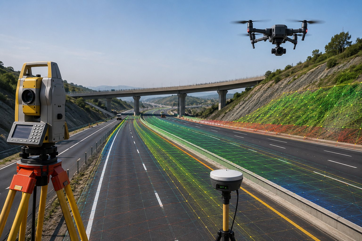
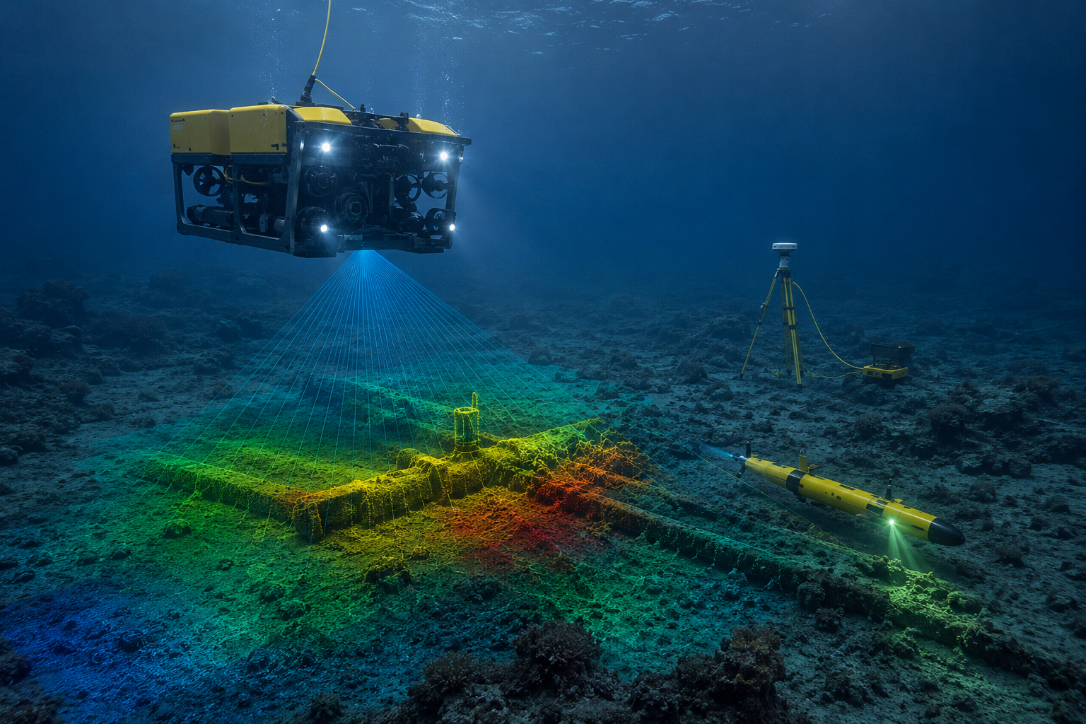
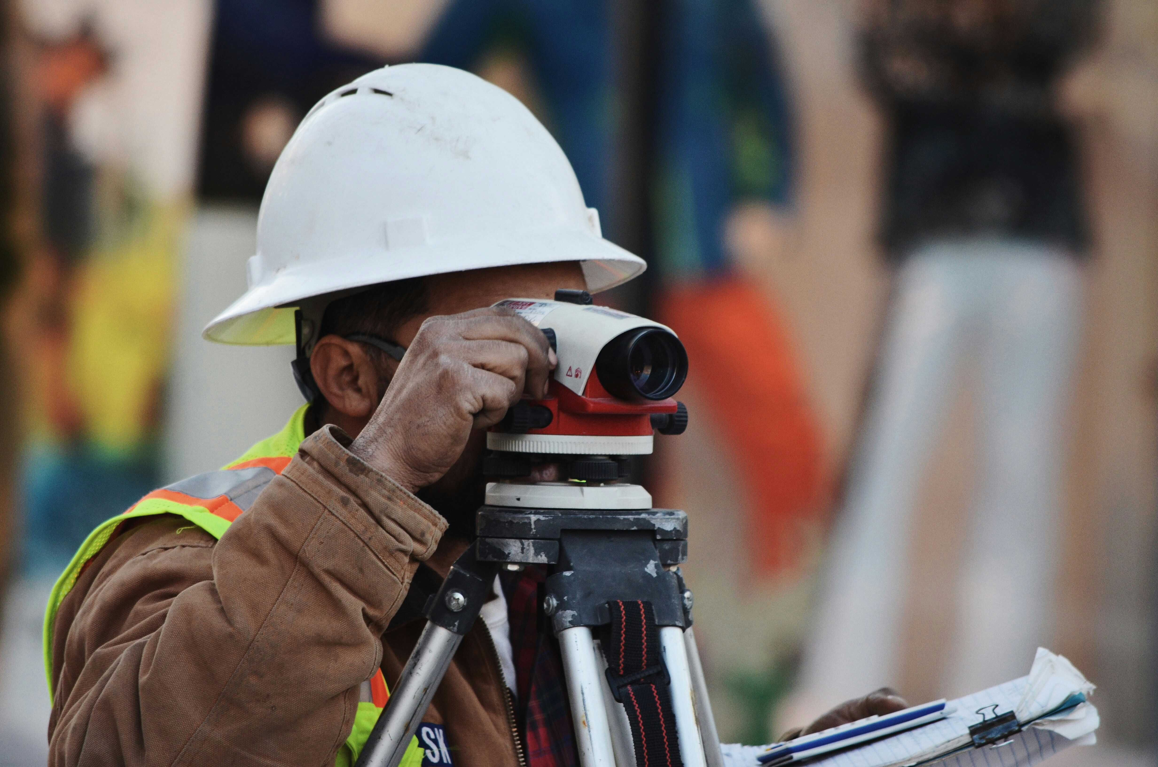
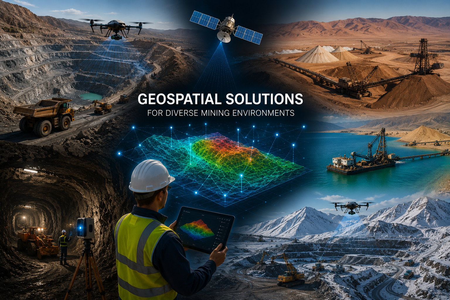
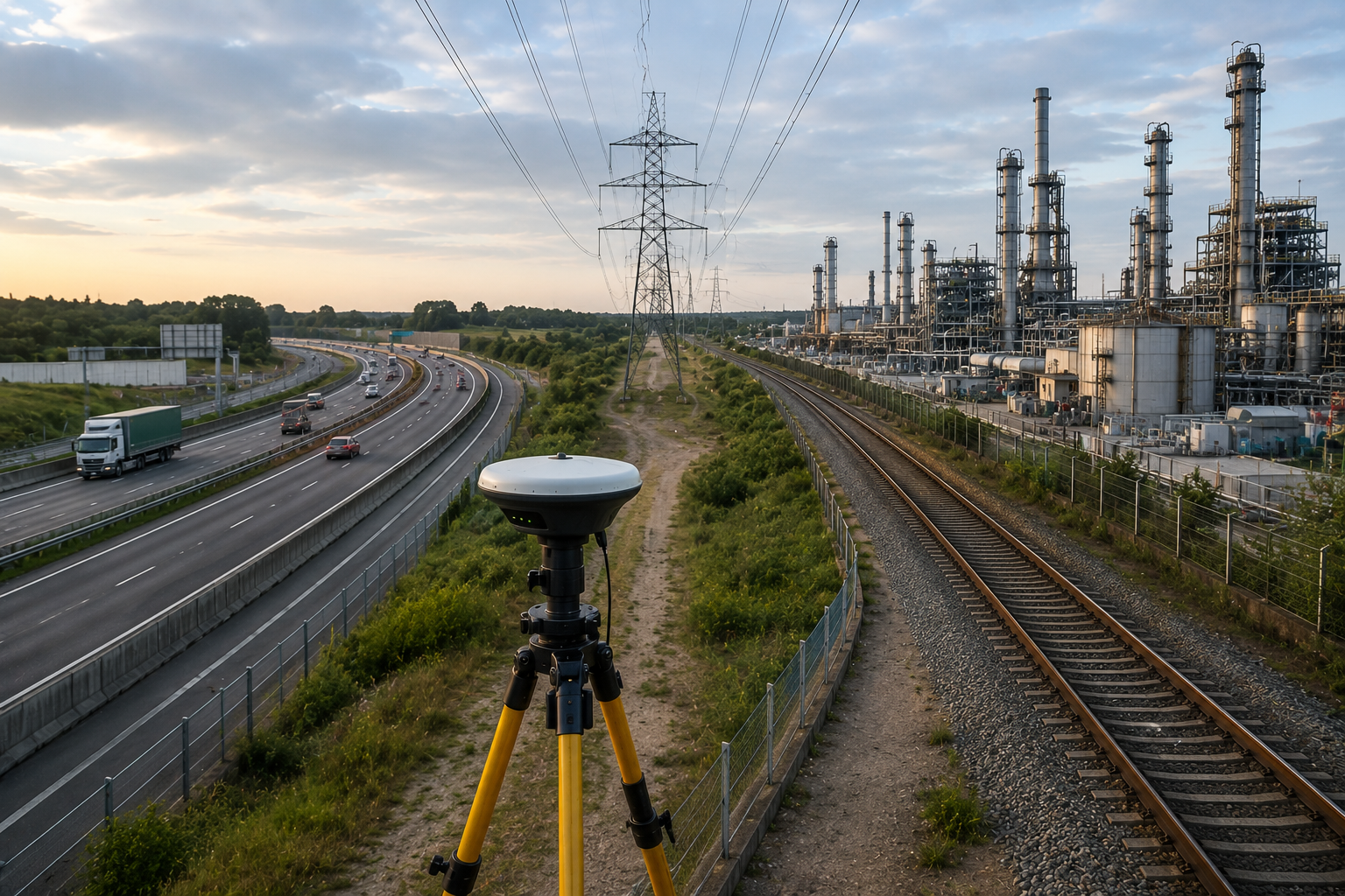
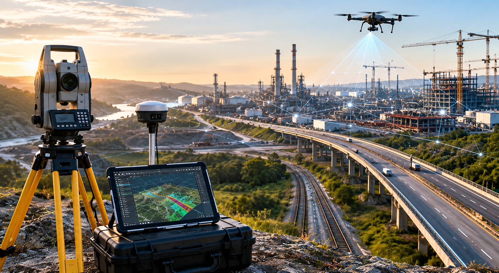
FIELD EXECUTION & DIGITAL MAPPING

Precision survey systems for complex terrain and infrastructure projects.

From topographical surveys and corridor alignment to drone mapping, LiDAR scanning, and hydrographic analysis, SATMOS delivers accurate field intelligence for planning, design, monitoring, and execution.

CORE SERVICES

Topographical, DGPS, drone & GIS workflows.

High-accuracy mapping systems supporting highways, mining, transmission corridors, waterways, railways, and industrial infrastructure.

Geospatial intelligence systems
ENGINEERING DELIVERABLES

CAD-ready outputs for planning and execution.

Deliverables include contour maps, topographical plans, longitudinal sections, earthwork calculations, GIS analysis, and infrastructure mapping datasets.

CORE SERVICES

Multi-disciplinary survey
and geospatial solutions.

SATMOS delivers integrated field surveying, drone intelligence, GIS mapping, LiDAR, hydrographic, and engineering support services for infrastructure and industrial projects.

01

Topographical & Land Survey

Contour Survey DGPS / RTK Alignment Survey

High-accuracy field surveys for highways, transmission lines, canals, mining zones, bridge alignments, and industrial infrastructure projects using modern survey instruments and experienced field teams.

02

Drone Survey & Monitoring

Orthomosaic Mapping Progress Monitoring Volume Analysis

UAV-based mapping and aerial intelligence systems supporting corridor surveys, earthwork calculations, waterbody analysis, project monitoring, and real-time infrastructure visibility.

03

GIS Mapping & Remote Sensing

Spatial Analysis Land Information Systems Data Conversion

End-to-end GIS workflows for infrastructure planning, urban development, resource mapping, geospatial analysis, and engineering-scale spatial intelligence systems.

04

LiDAR & GPR Investigation

3D Terrain Modeling Subsurface Investigation High Accuracy Mapping

Advanced LiDAR and Ground Penetrating Radar systems for terrain intelligence, underground utility detection, aerial mapping, bathymetric analysis, and infrastructure-grade precision surveys.

PROJECT EXPERIENCE

Field execution,
engineering intelligence
& real-world terrain analysis.

Highway infrastructure survey
HIGHWAY & CORRIDOR SURVEY

Large-scale infrastructure alignment and terrain mapping workflows.

Drone survey operation
UAV OPERATIONS

Real-time aerial intelligence for infrastructure monitoring.

ENGINEERING SYSTEMS

DGPS, GIS, LiDAR & hydrographic integration.

Spatial intelligence workflows supporting infrastructure, mining, waterways, industrial planning, and engineering execution.

Hydrographic survey operations
HYDROGRAPHIC SURVEY

Waterbody mapping, depth analysis & terrain profiling.

TECHNOLOGY & EQUIPMENT

Advanced field systems
for accurate surveying
and mapping operations.

SATMOS integrates modern survey instruments, drone systems, GIS software, LiDAR platforms, and precision engineering workflows to support infrastructure, industrial, mining, and hydrographic projects.

Advanced geospatial and survey systems
INTEGRATED FIELD & DIGITAL WORKFLOWS

Precision-driven systems for terrain, infrastructure, and spatial intelligence.

Our workflows combine RTK survey systems, UAV mapping, GIS analysis, LiDAR scanning, hydrographic equipment, and engineering deliverables for accurate project execution.

01

DGPS & RTK Survey Systems

High-accuracy positioning systems for topographical surveys, corridor mapping, infrastructure alignment, and engineering-grade field measurements.

02

Drone & GIS Intelligence

UAV mapping, orthomosaic generation, GIS analysis, and remote sensing systems supporting planning, monitoring, and terrain visualization.

03

LiDAR & Hydrographic Systems

Advanced terrain modeling, depth measurement, bathymetric analysis, subsurface investigation, and 3D mapping workflows for engineering and environmental projects.

EXECUTION WORKFLOW

Structured field workflows
for accurate project delivery.

SATMOS follows a systematic execution process combining field intelligence, geospatial systems, precision validation, and engineering deliverables for reliable project outcomes.

01

Site Reconnaissance & Planning

Initial site understanding, project scope analysis, route planning, control point identification, and workflow preparation before field deployment.

02

Field Survey & Data Capture

DGPS, total station, drone, LiDAR, hydrographic, and field survey systems used for accurate terrain and infrastructure data collection.

03

Processing & Spatial Analysis

GIS processing, contour generation, orthomosaic preparation, terrain modeling, CAD drafting, and engineering analysis for actionable project intelligence.

04

Deliverables & Project Support

Delivery of topographical plans, sections, GIS outputs, quantity calculations, reports, and engineering-ready datasets for execution and decision-making.

OPERATIONAL STRENGTH

Built for precision,
scale & infrastructure execution.

SATMOS combines multidisciplinary survey expertise, geospatial intelligence, engineering workflows, and field execution systems to support infrastructure and industrial projects across varied terrain conditions.

01
High Accuracy
DGPS & RTK Precision Workflows

Advanced positioning systems supporting infrastructure alignment, contour mapping, and engineering-grade survey operations.

02
Multi-Service
Integrated Survey Ecosystem

Land survey, drone mapping, GIS, LiDAR, hydrographic, and GPR systems integrated under one workflow structure.

03
Infrastructure Focus
Engineering & Industrial Projects

Survey and mapping support for highways, railways, mining, waterways, utilities, and industrial development sectors.

Infrastructure and survey execution
FIELD EXECUTION

Reliable field operations across challenging environments.

INDUSTRIES WE SERVE

Surveying and geospatial
systems across diverse sectors.

SATMOS supports public infrastructure, industrial development, transportation, mining, utilities, waterways, and engineering projects through integrated survey and mapping workflows.

Infrastructure and industrial survey
INFRASTRUCTURE & ENGINEERING

Highway, railway, industrial & utility corridor surveys.

Survey and mapping systems supporting alignment planning, topographical analysis, earthwork monitoring, utility networks, and infrastructure execution workflows.

01

Mining & Terrain Analysis

Drone mapping, contour surveys, stockpile analysis, terrain intelligence, and earthwork volume calculations for mining operations.

02

Waterways & Hydrographic Systems

River, canal, and waterbody survey systems including depth analysis, cross sections, and bathymetric mapping workflows.

03

Urban & Spatial Development

GIS mapping, land information systems, planning support, remote sensing, and geospatial intelligence for urban and industrial projects.

EXPERIENCE & COVERAGE

Trusted survey workflows
for infrastructure and engineering projects.

SATMOS supports multidisciplinary projects through integrated field operations, spatial intelligence, engineering deliverables, and scalable survey systems across varied environments and industries.

1200+

KM Surveyed

45+

Ongoing Projects

12+

States Covered

150+

Drone Operations

Infrastructure survey and engineering operations
FIELD EXECUTION & ENGINEERING SUPPORT

Supporting infrastructure, industrial, mining, and utility projects with integrated survey systems.

01

Infrastructure & Transportation

Highway, railway, bridge, canal, and transmission corridor surveys supporting planning, monitoring, and execution workflows.

02

Mining & Industrial Operations

Drone mapping, volume calculations, terrain analysis, and GIS systems supporting industrial and mining environments.

PROJECT TYPES & SECTORS
Highways
Railways
Mining
Utilities
Waterways
Industrial
LET’S BUILD WITH PRECISION

Surveying,
mapping & engineering
systems for modern projects.

SATMOS delivers multidisciplinary survey, drone, GIS, LiDAR, hydrographic, and infrastructure support services for engineering and industrial projects across India.

CONTACT INFORMATION
Office

Gandhi Mela Path, Tundi Road,
Govindpur, Dhanbad,
Jharkhand – 828109

Infrastructure survey systems
SATMOS INFRA TECH

Integrated geospatial workflows for infrastructure and industrial development.