
SATMOS Infra Tech delivers precision-driven survey engineering, drone mapping, GIS systems, LiDAR, hydrographic, and infrastructure intelligence solutions for highways, industrial corridors, waterways, utilities, mining, and large-scale development projects.
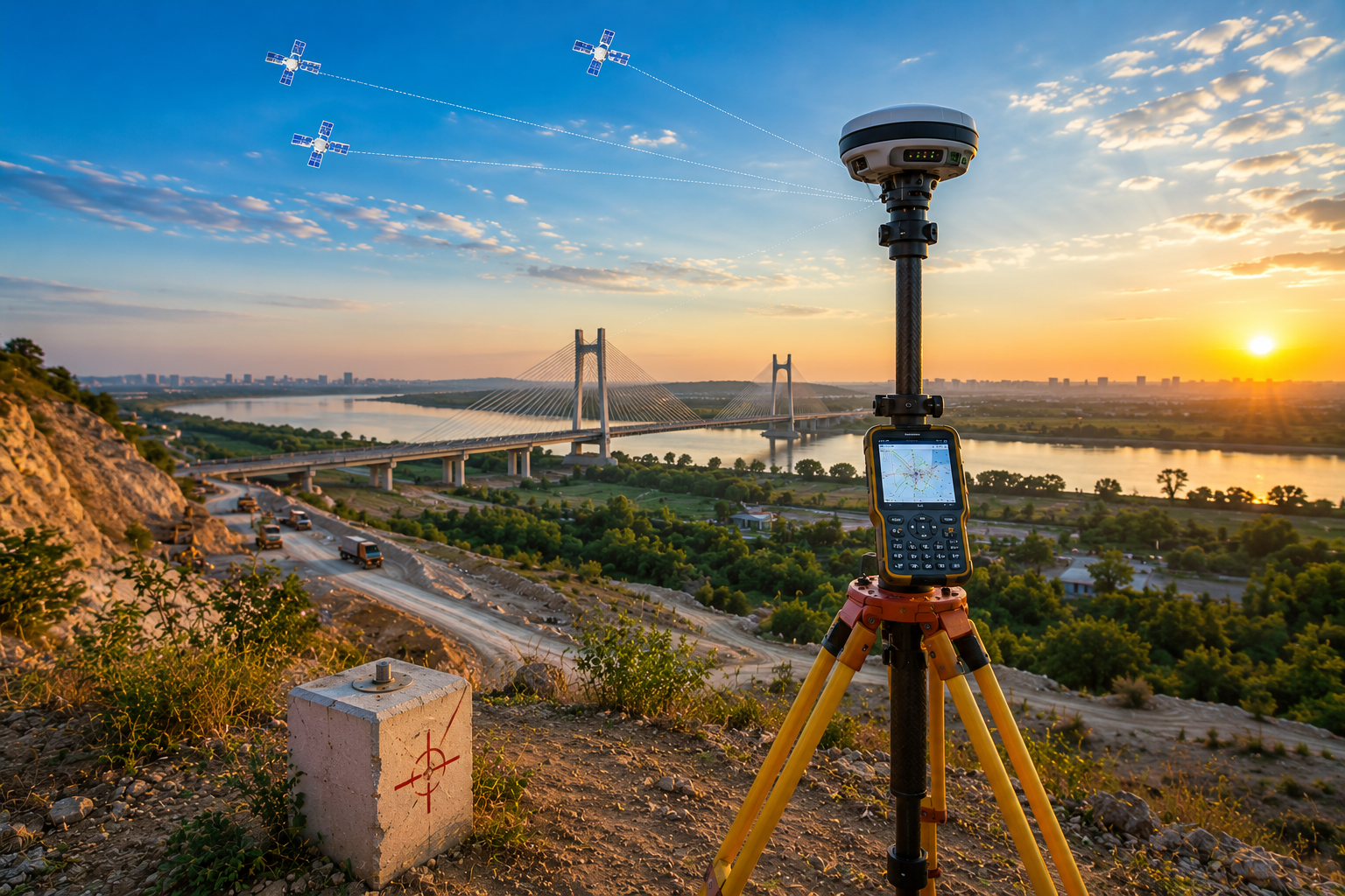
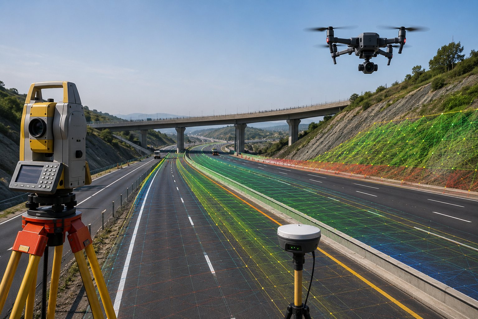
DGPS, RTK, topographical, corridor, and infrastructure surveys.
UAV mapping, progress monitoring, terrain analysis, and volumetric workflows.
Spatial intelligence, data systems, 3D terrain modeling, and geospatial analytics.

SATMOS Infra Tech operates at the intersection of geospatial engineering, field surveying, infrastructure intelligence, and modern mapping technologies.
Our workflows combine advanced survey systems, UAV mapping, GIS analysis, LiDAR technologies, hydrographic solutions, and engineering execution support to generate reliable spatial data for high-accuracy infrastructure environments.
From highways and industrial corridors to waterways, mining zones, utilities, and terrain-sensitive infrastructure, SATMOS focuses on delivering dependable field intelligence that improves planning, execution, monitoring, and decision-making.
Accurate survey execution using modern geospatial systems.
UAV, DGPS, GIS, LiDAR, and hydrographic integration.
Spatial analysis supporting infrastructure planning & execution.
SATMOS Infra Tech delivers multidisciplinary survey engineering and spatial intelligence services designed for infrastructure planning, field execution, monitoring, terrain analysis, and engineering workflows.
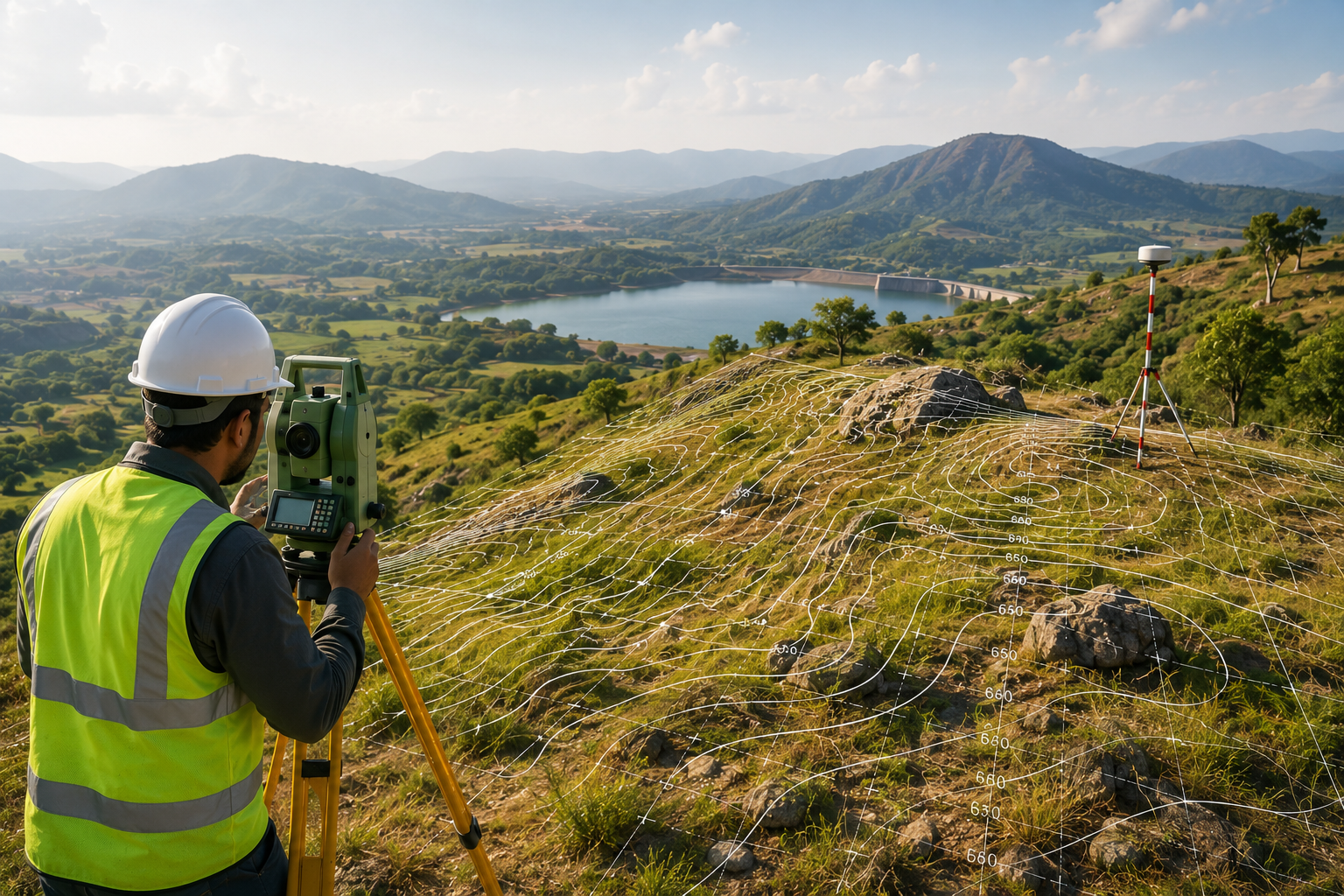
DGPS, RTK, contour, alignment, canal, transmission, corridor, and infrastructure survey solutions for planning and execution environments.

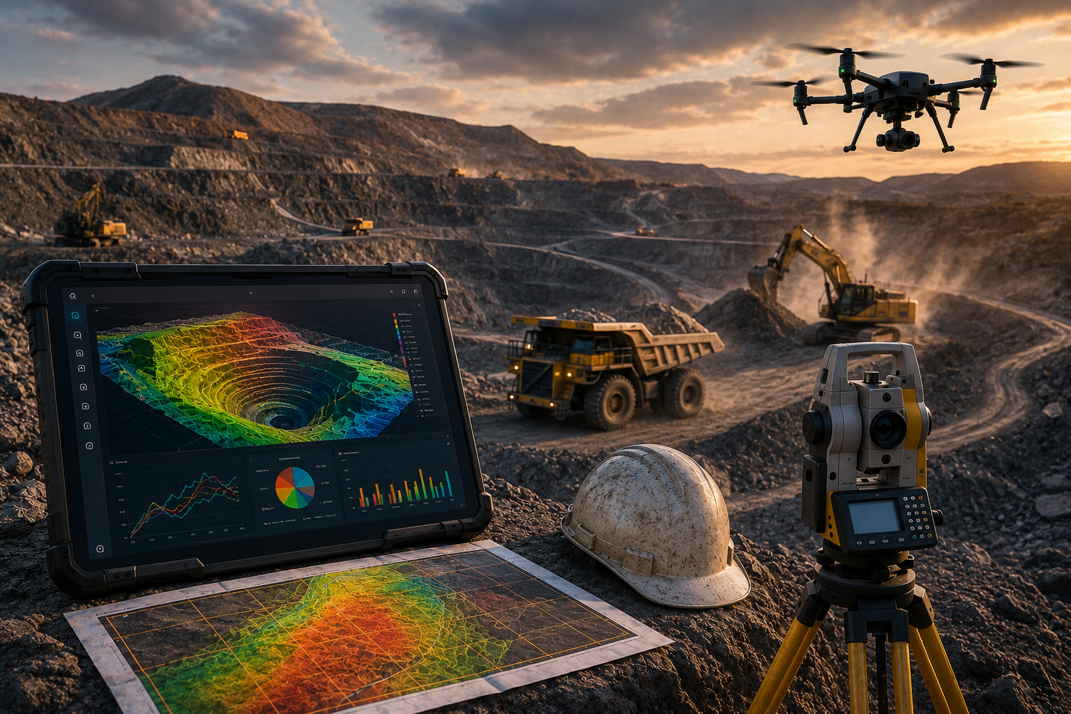
UAV mapping, corridor survey, terrain analysis, progress monitoring, volumetric calculations, and aerial intelligence workflows.
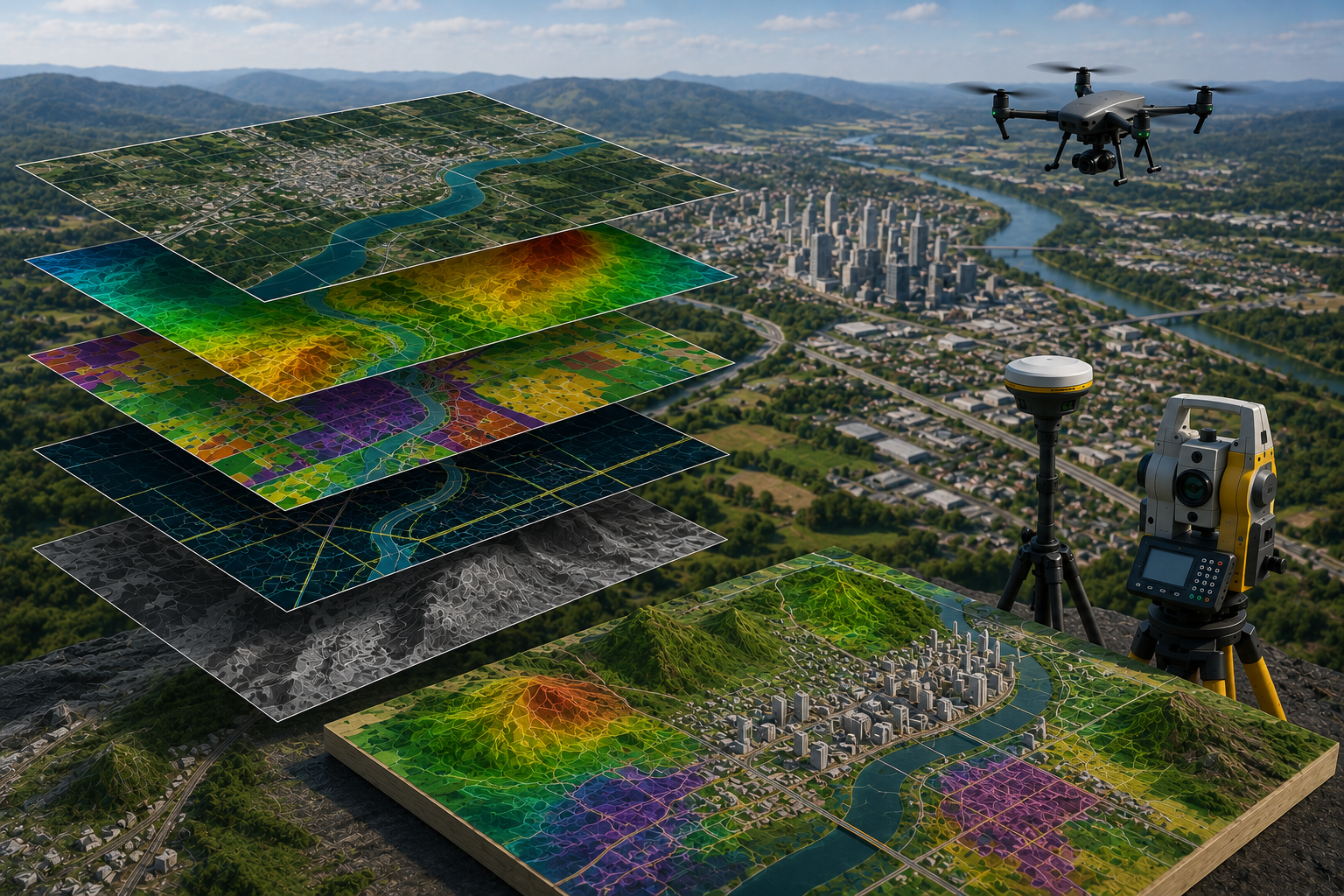
GIS systems, land information workflows, urban planning support, mapping analytics, and geospatial data conversion.
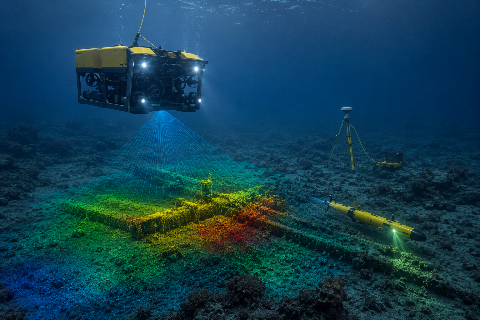
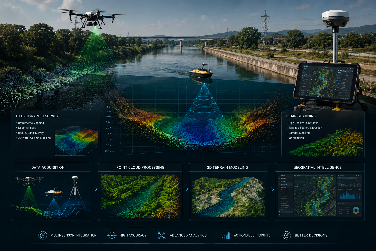
River and canal survey, depth analysis, bathymetric workflows, LiDAR scanning, 3D terrain modeling, and advanced geospatial intelligence systems.
SATMOS combines advanced field equipment, intelligent geospatial systems, and precision engineering workflows to support high-accuracy infrastructure execution.
High-accuracy positioning workflows supporting infrastructure alignment, contour mapping, and precision survey execution.
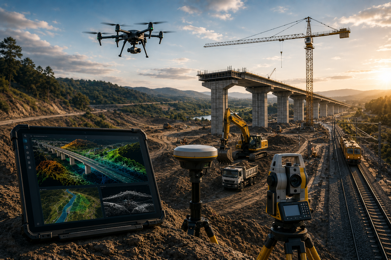
Real-time aerial mapping, corridor intelligence, progress monitoring, and terrain analysis systems.
Advanced spatial scanning and terrain intelligence workflows for infrastructure-scale environments.


SATMOS supports infrastructure-driven industries with precision surveying, mapping systems, terrain intelligence, monitoring, and engineering workflows tailored for complex operational environments.
Alignment surveys, corridor mapping, earthwork analysis, and infrastructure monitoring systems.

Spatial systems supporting transmission line survey, utility mapping, infrastructure alignment, and engineering execution.
Site understanding, terrain evaluation, and execution preparation.
UAV, DGPS, LiDAR, and engineering survey operations.
GIS analysis, terrain modeling, mapping, and reporting systems.
SATMOS follows an integrated field-to-data workflow combining advanced survey technologies, engineering intelligence, terrain analytics, and spatial systems to support infrastructure-scale project environments.
Accurate survey execution using modern engineering and geospatial systems.
GIS, mapping, terrain modeling, and infrastructure analytics integrated into execution workflows.
Designed for highways, utilities, waterways, industrial, and terrain-sensitive projects.
Combining ground execution with intelligent spatial systems for infrastructure decision-making.
SATMOS combines engineering precision, advanced survey technologies, intelligent spatial systems, and disciplined field execution to support infrastructure environments where accuracy and reliability directly impact decision-making.

High-accuracy workflows using DGPS, RTK, UAV, LiDAR, and geospatial technologies for terrain-sensitive environments.
Survey engineering, GIS mapping, hydrographic systems, drone intelligence, and infrastructure support integrated into unified workflows.
Designed to support highways, waterways, mining, utility corridors, industrial environments, and large-scale infrastructure execution.
Converting field data into actionable mapping, terrain analysis, planning support, and infrastructure intelligence systems.

SATMOS Infra Tech supports infrastructure, engineering, industrial, utility, water, and terrain-sensitive projects with precision survey systems, geospatial intelligence, UAV workflows, GIS mapping, LiDAR, and field execution support.
Highway, utility, industrial, and corridor workflows.
GIS systems, terrain intelligence, mapping, and analytics.
DGPS, RTK, LiDAR, UAV, and hydrographic systems.